Fire Analyses

← CLIMAAX – CLIMol

Analisi degli incendi boschivi in Molise basate sugli algoritmi del CLIMAAX Toolbox.

Didascalie originali in inglese. Seleziona un grafico per aprirlo alla risoluzione originale.

Indice: Hazard · Risk · Vulnerability

Hazard

Future Wildfire Hazard (RCP8.5, 2050–2051)
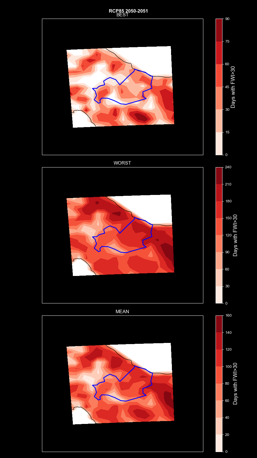
Future Wildfire Hazard (RCP8.5, 2050–2051)
Future wildfire hazard map for the Molise region (Italy) under the RCP 8.5 emissions scenario, showing the projected Fire Weather Index (FWI) for the 2050–2051 period

Wildfire Hazard Map (FWI-Based)

Wildfire Hazard Map (FWI-Based)
General hazard map illustrating overall meteorological conditions favorable to fire occurrence.

Historical vs. RCP8.5 Wildfire Hazard Comparison
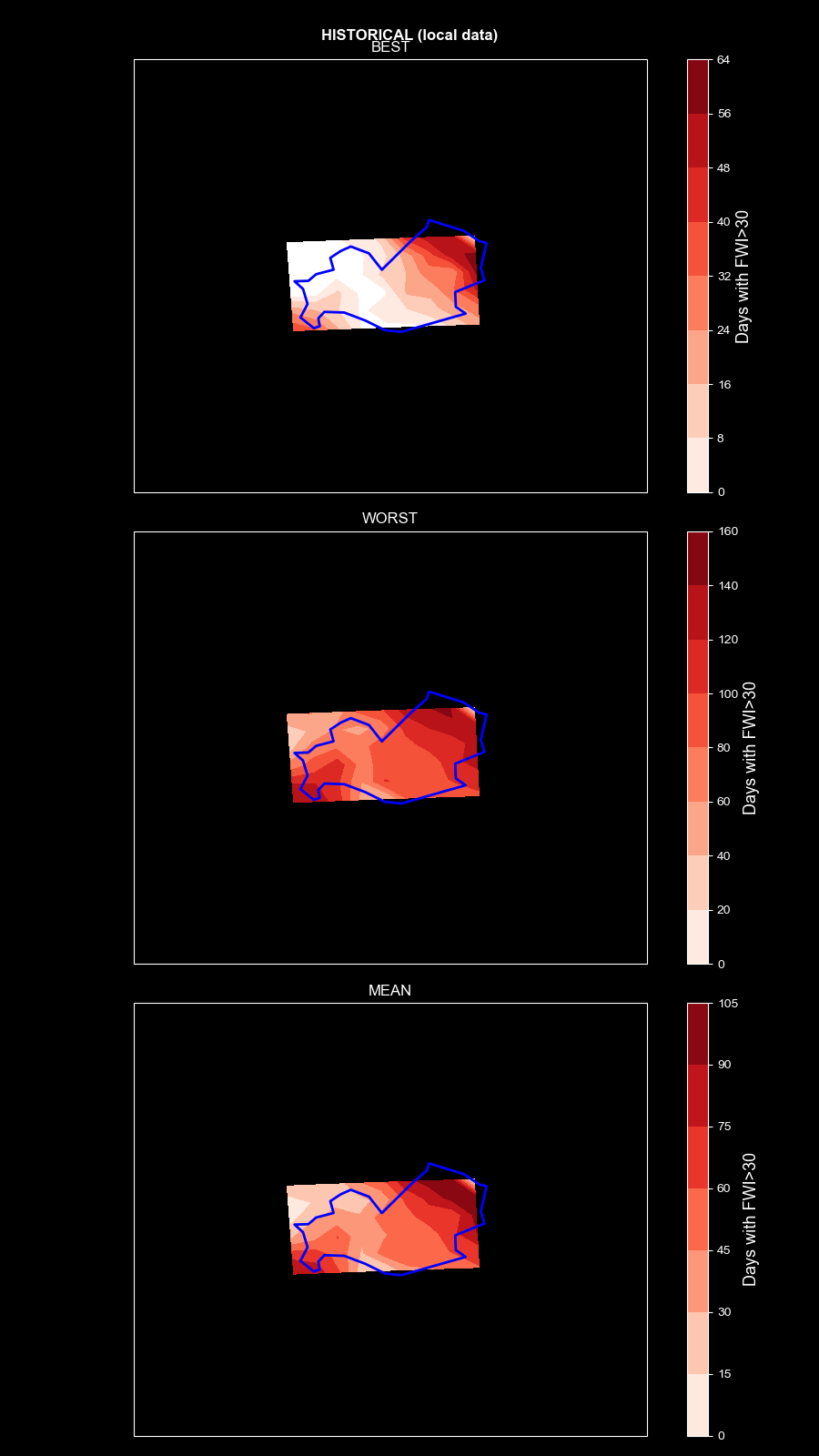
Historical vs. RCP8.5 Wildfire Hazard Comparison
Comparative hazard assessment between historical baseline conditions and high-emissions RCP8.5 projections.

Risk

Historical Wildfire Risk (1982–2022)
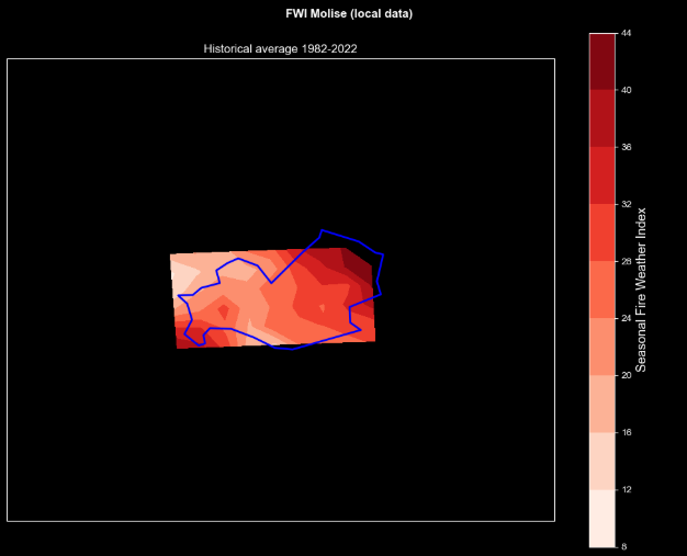
Historical Wildfire Risk (1982–2022)
Baseline assessment showing the 40-year historical average wildfire risk derived from FWI data.

Projected Wildfire Risk (RCP2.6, 2045–2054)
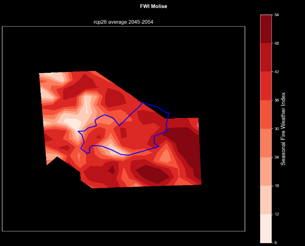
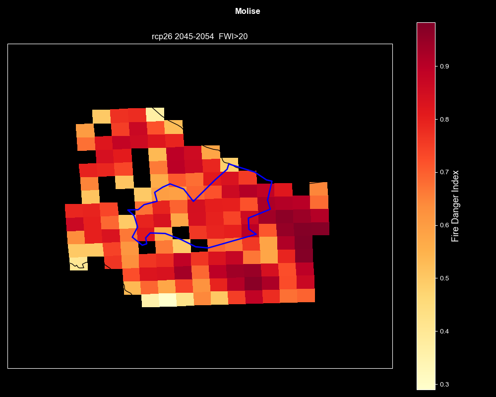
Projected Wildfire Risk (RCP2.6, 2045–2054)
Average projected wildfire risk based on FWI under the low-emissions RCP2.6 scenario.

Overall Wildfire Risk (FWI-Based)

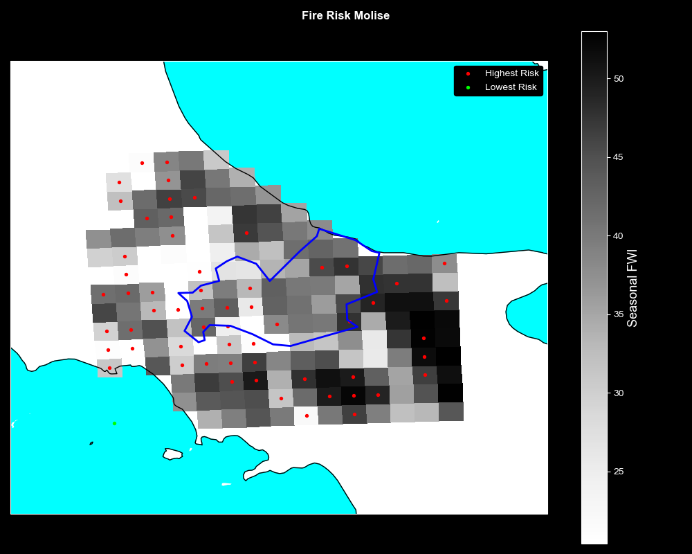
Overall Wildfire Risk (FWI-Based)
Integrated wildfire risk assessment based on Fire Weather Index (FWI) mapping.

Vulnerability

Wildfire Vulnerability: Burnable Vegetation (RCP2.6, 2045–2054)
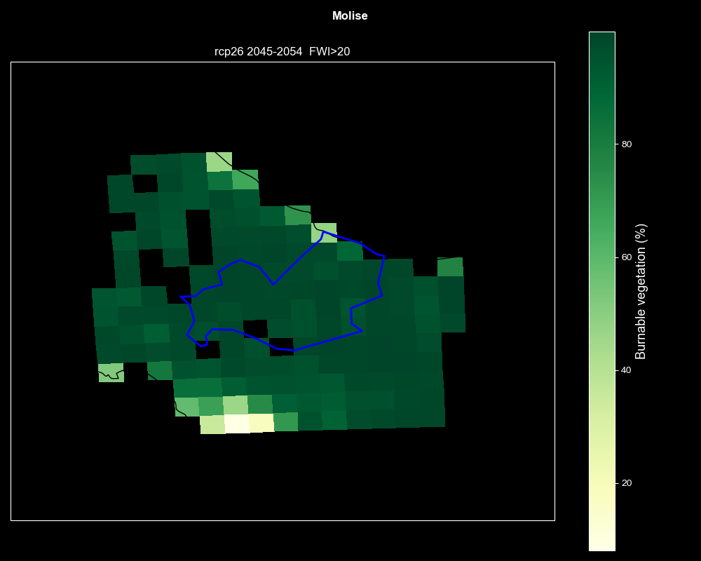
Wildfire Vulnerability: Burnable Vegetation (RCP2.6, 2045–2054)
Evaluates vegetation susceptibility and fuel availability for wildfire propagation under RCP2.6.

Wildfire Vulnerability: Fire Weather Index (RCP2.6, 2045–2054)
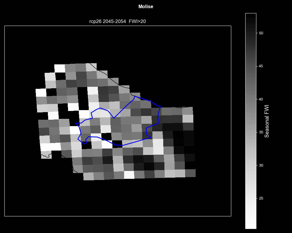
Wildfire Vulnerability: Fire Weather Index (RCP2.6, 2045–2054)
Vulnerability assessment derived from projected meteorological fire risk factors (FWI) under RCP2.6.

Wildfire Vulnerability: Ecological Irreplaceability (RCP2.6, 2045–2054)
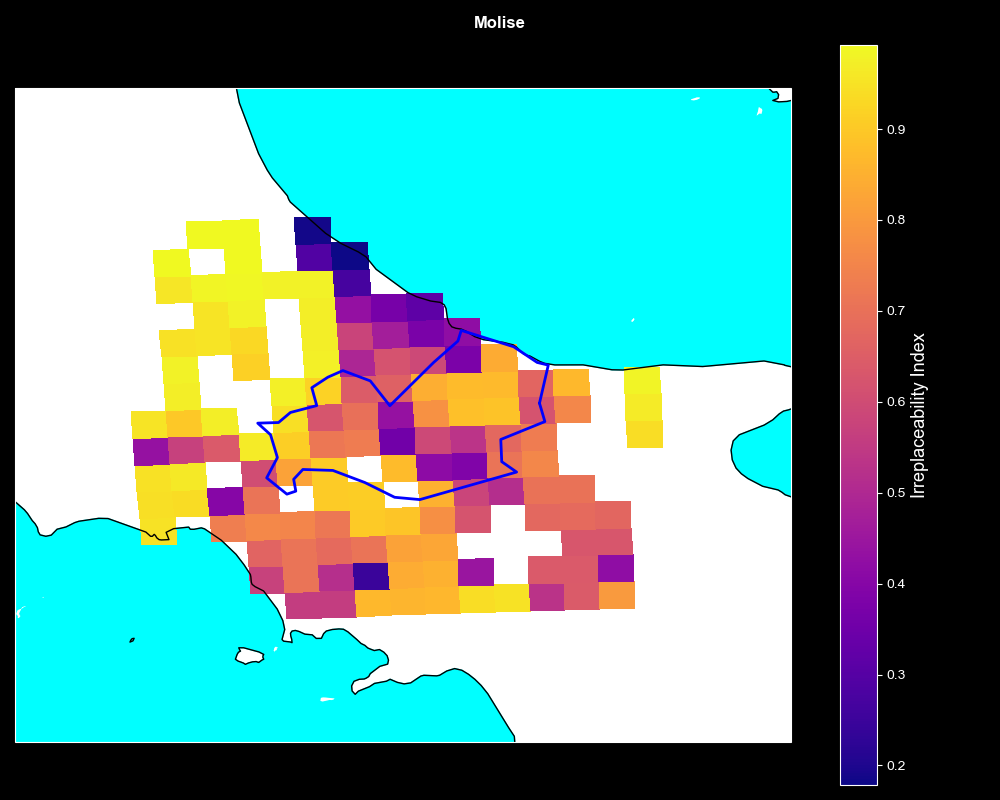
Wildfire Vulnerability: Ecological Irreplaceability (RCP2.6, 2045–2054)
Measures vulnerability based on irreplaceability of ecological species and habitats at risk under RCP2.6.

Wildfire Vulnerability: Population Density (RCP2.6, 2045–2054)
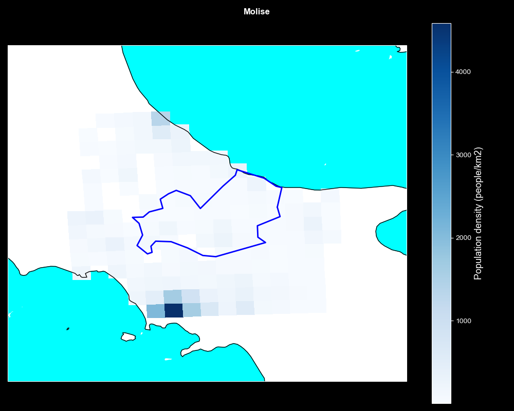
Wildfire Vulnerability: Population Density (RCP2.6, 2045–2054)
Analyses wildfire vulnerability in terms of human exposure and population density distribution under RCP2.6.

Wildfire Vulnerability: Protected Areas (RCP2.6, 2045–2054)
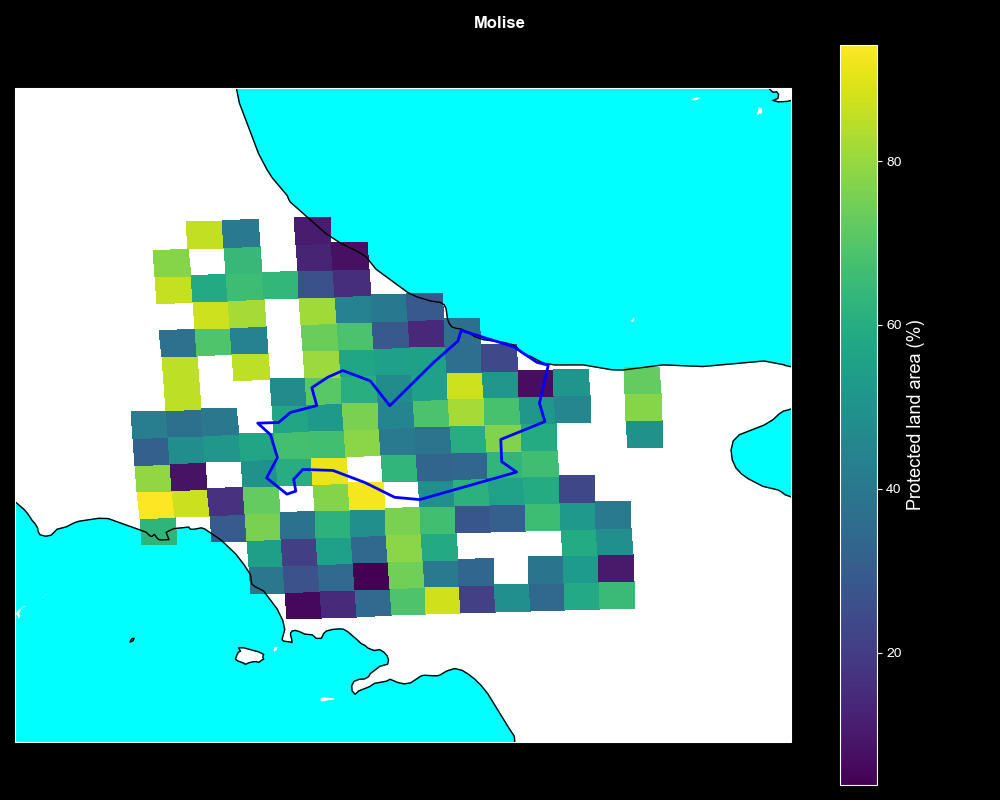
Wildfire Vulnerability: Protected Areas (RCP2.6, 2045–2054)
Maps wildfire vulnerability specifically within protected nature reserves and ecological zones under RCP2.6.

Wildfire Vulnerability: Restoration Costs (RCP2.6, 2045–2054)
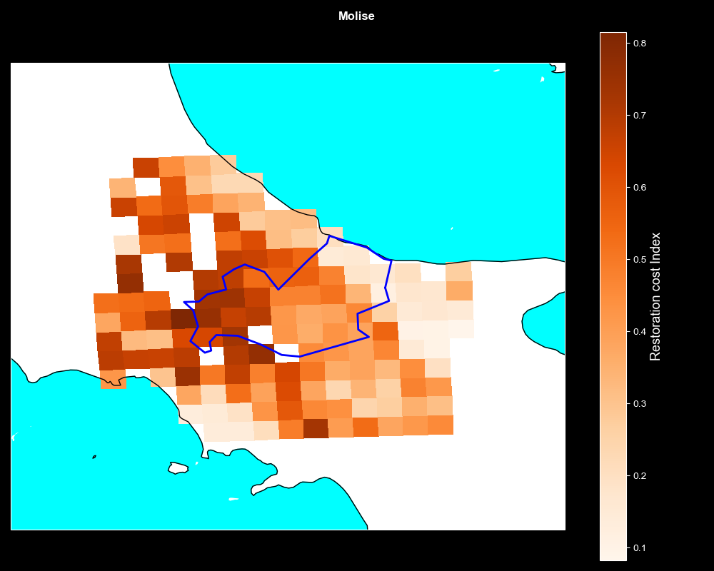
Wildfire Vulnerability: Restoration Costs (RCP2.6, 2045–2054)
Evaluates vulnerability based on potential ecosystem restoration costs following a wildfire under RCP2.6.

Wildfire Vulnerability: Wildland-Urban Interface (RCP2.6, 2045–2054)
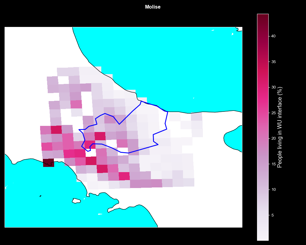
Wildfire Vulnerability: Wildland-Urban Interface (RCP2.6, 2045–2054)
Assesses wildfire vulnerability focusing on the Wildland-Urban Interface (WUI) area under the low-emissions RCP2.6 scenario.